Storm Chase Details
Miles Logged: 785
States Chased: TX
Largest Hail Encountered: 2.00 in.
Highest Wind Encountered: 70 MPH
Spotter Network Reports: 1
Severe Risks: SPC Outlooks
Severe Reports: Storm Reports
There were 2 distinct targets this day, both of them had their issues. The northern target in Kansas was cut off from moisture return by ongoing storms in Oklahoma. The south target in Texas had amazing parameters but poor mid level lapse rates.
Choosing Texas
Ultimately I chose Texas, as that is just where the greatest potential to me seemed for tornadic supercells with very rich low level gulf moisture and a very strong jet nosing in from the SW.
I left Norman pretty early and headed south. A tornado watch was issued, and I realized I needed to get further southwest. In retrospect I should have taken I-20 west, but I headed down 377 southwest out of Fort Worth. I took 377 all the way to Stephenville where storms were firing just to the west. They were rapidly becoming severe after initiation, so I headed west towards Dublin and onto Rising Star.
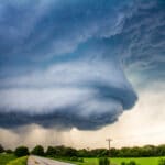
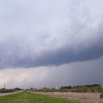
I intercepted the first storm near Rising Star, albeit with no data. The area around Stephenville is a huge Verizon hole. The storm was tornado warned according to the noaa weather radio, and as I quickly found out – HP as heck and moving fast.
Stephenville Storms
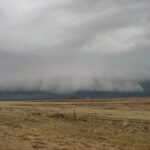
I let the line of storms overtake me in Stephenville. The storm packed 80 mph winds and debris flying through the air. There was also some hail with the storm. I dropped south in hopes of getting something a little more discrete, heading to Hico and then southwest. The storms further south were struggling. I gave up shortly after they dropped the severe warnings and headed towards Arkansas.
