Storm Chase Details
Miles Logged: 408
States Chased: OK, TX
Severe Risks: SPC Outlooks
Severe Reports: Storm Reports
With marginal upper level support, I knew the chances of a tornado were extremely low. The temperatures were also very warm, almost 100F, so dewpoint spreads would be high. Nonetheless, I headed down towards Wichita Falls. There would be severe storms in North Texas and I was hoping for something photogenic and exciting.
First Storms
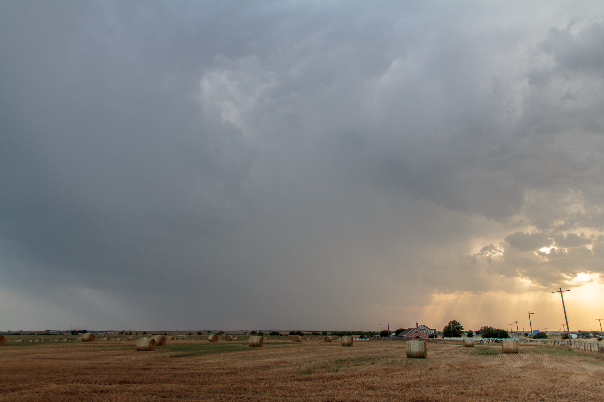
The first storms of the day started to fire southeast of Wichita Falls. They fell apart as the cap was suppressing development. Another storm was going up near Seymour where surface temperatures were over 100F and dewpoints were in the 40s.
I headed west to check out the storms near Seymour and watched it fall apart. Still too hot.
The first storms went up southeast of Wichita Falls and fell apart in the warm sector. Strong capping and weak upper levels seemed to suppress larger development.
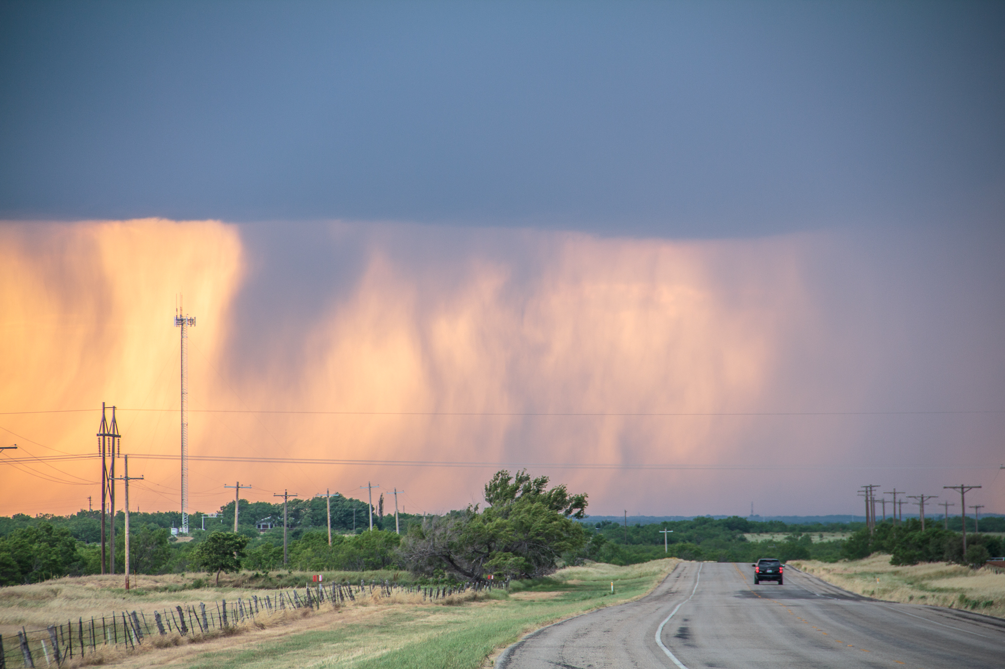
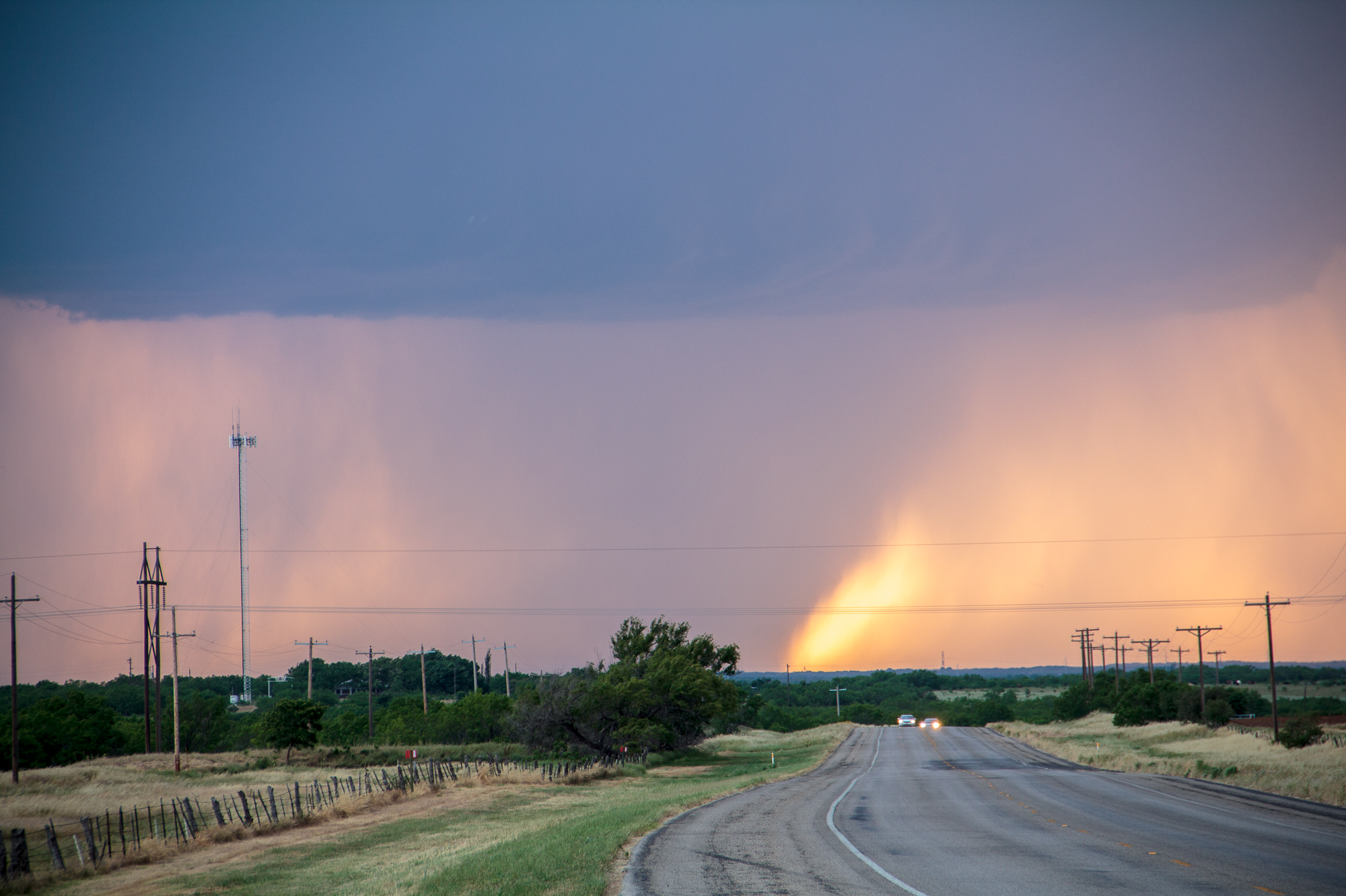
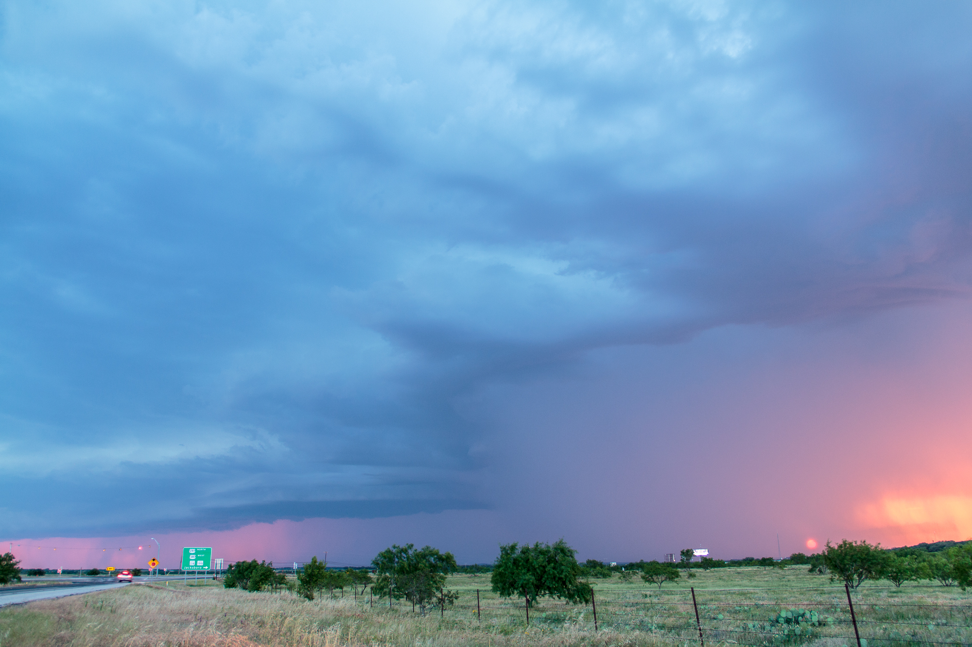
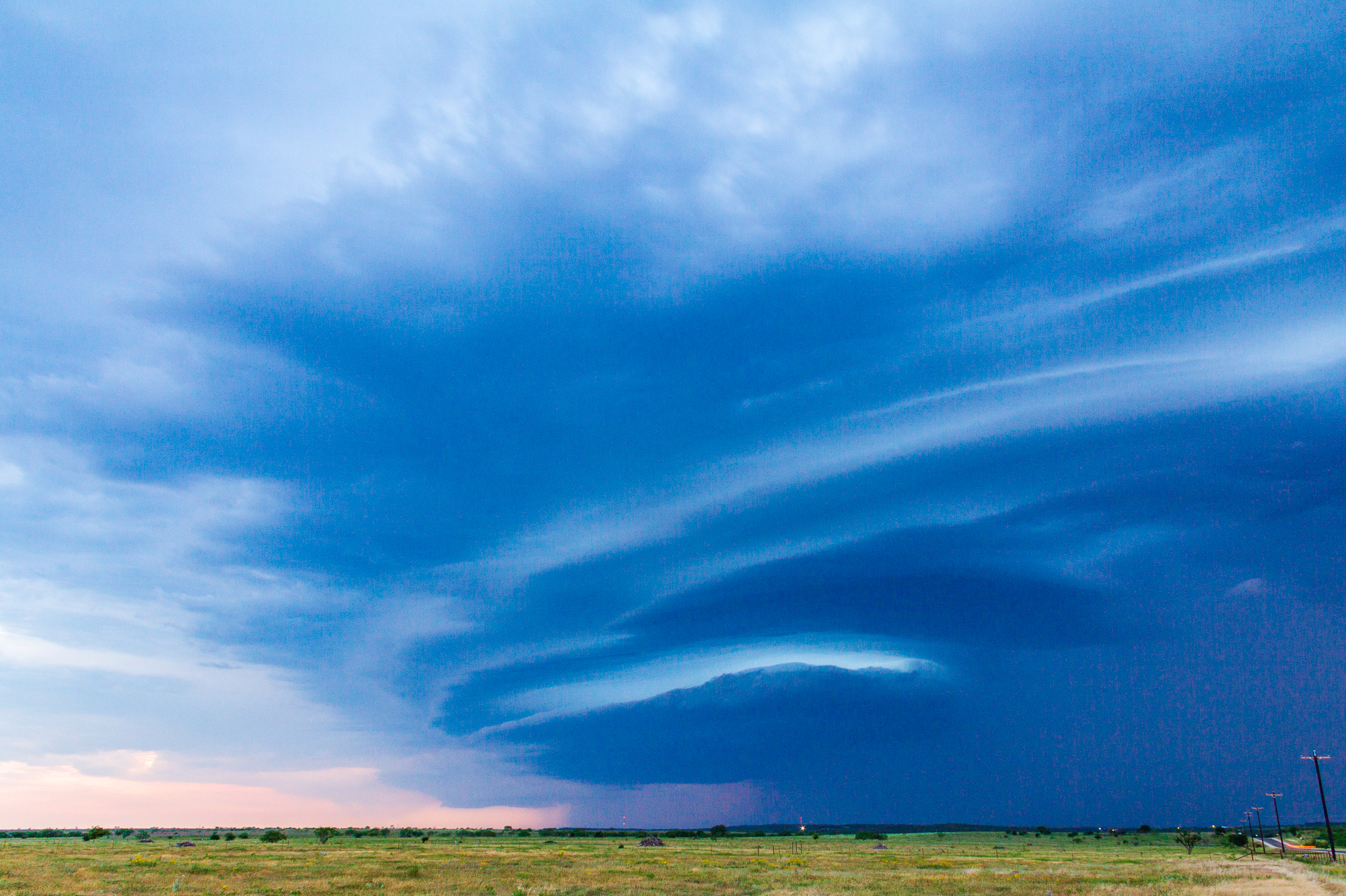
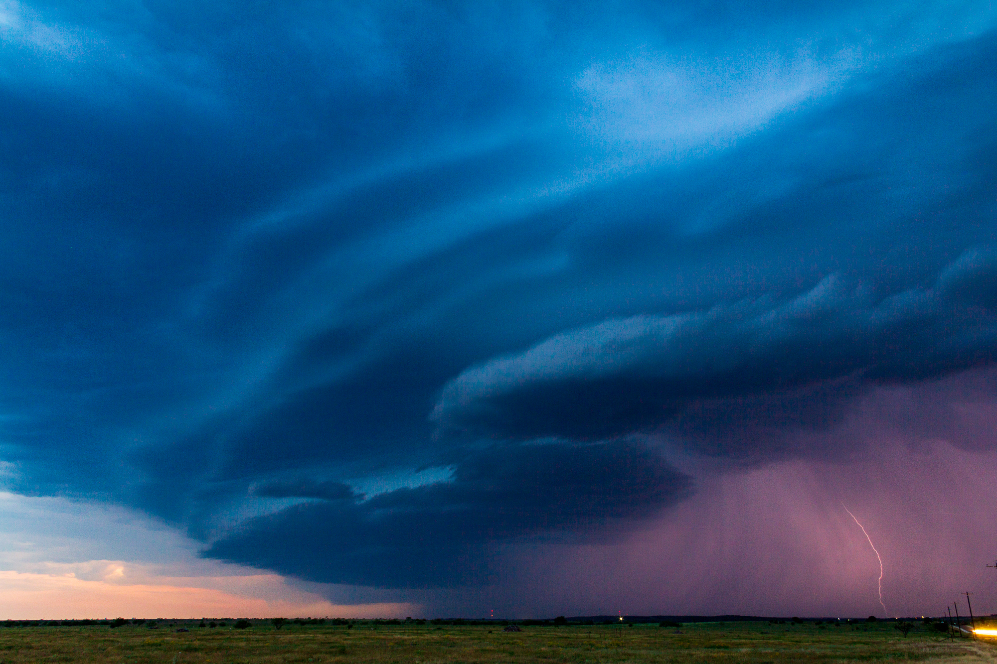
Shortly before sunset, we finally started to see more widespread and more intense development. A strong storm fired near Archer City and additional cells to the south near Graham and Newcastle. It appeared the small upper wave had finally started overspreading the area. The storms organized into a linear/bowing segment and produced damaging winds west of Jacksboro.

The storm was quite picturesque with the setting sun. I was able to snap some photos as I continued to Jacksboro and then east on 380.
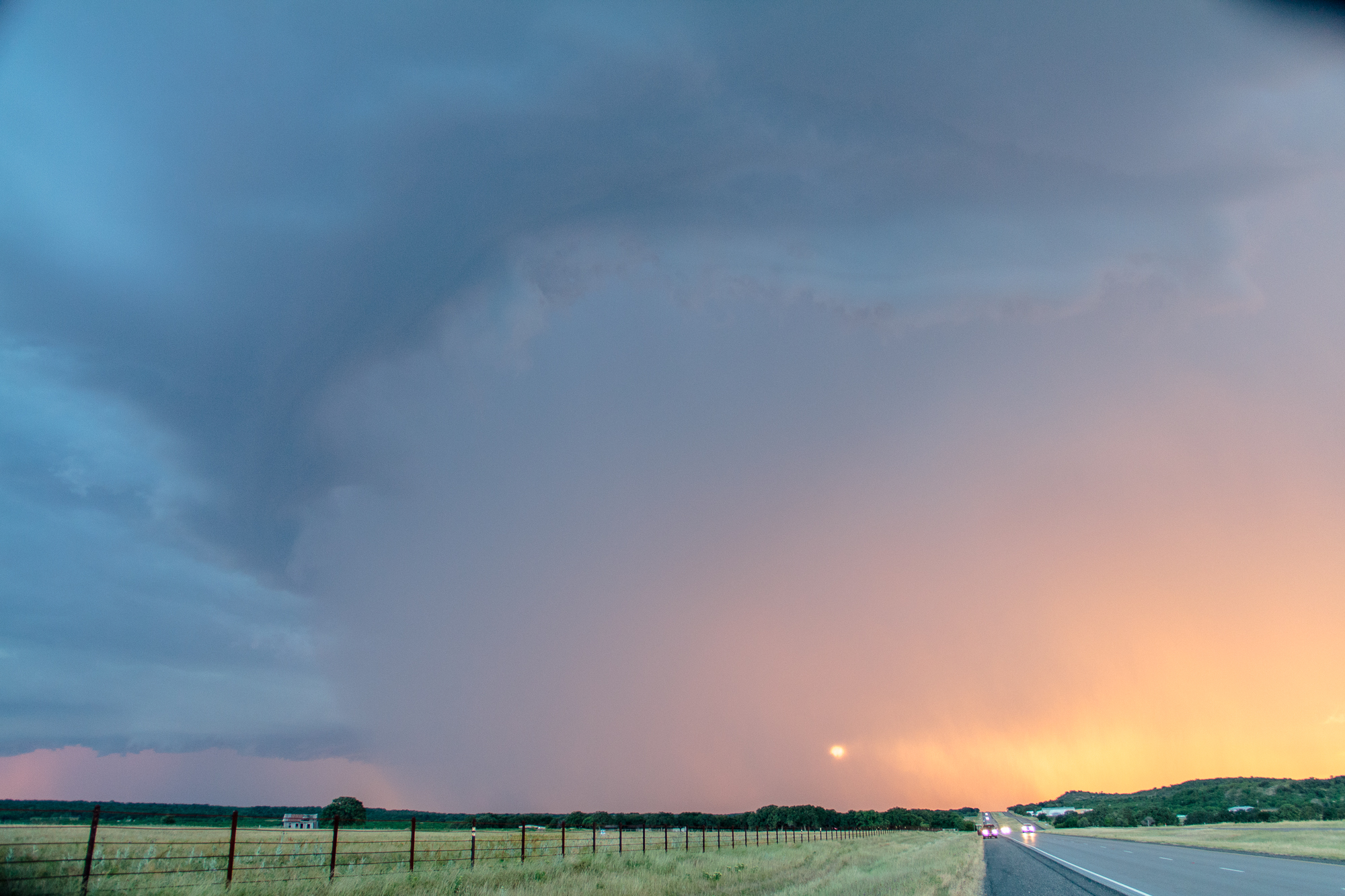
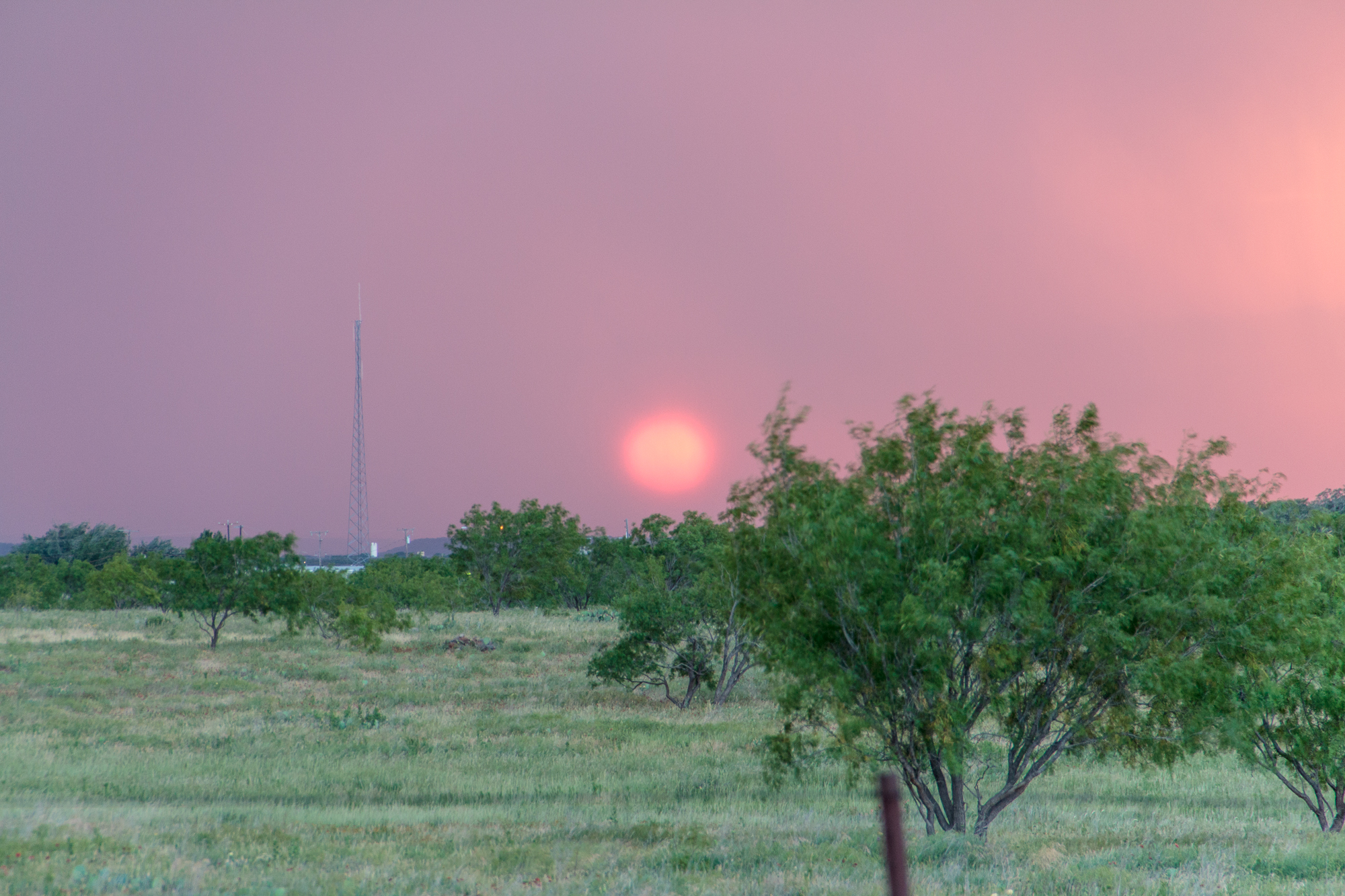
I continued east towards I-35 on US380. The sun was setting and it was time to head back to Norman.


