Storm Chase Details
Miles Logged: 338
States Chased: MI
Spotter Network Reports: 1
Severe Risks: SPC Outlooks
Severe Reports: Storm Reports
This day started out as quite a marginal severe weather day, and after the morning cloud cover I had almost written it completely off. I got a lot of tasks done during the day, including mowing the lawn and getting caught up on bills and changing the oil in my truck.
Aric Cylkowski and I decided eventually to head out towards the southeast corner of Michigan as that is where the HRRR model was breaking out precip including Supercells. We headed down US127 towards Jackson.
A cell had fired over Lake Michigan and was heading east inland across the southern tier of counties, so we headed west on I-94 towards Coldwater where we were going to go west to intercept.
The cell died off over Berrien and Cass counties, so we just sat in Coldwater waiting. More storms went up west of Allegan county, but we hesitated for a bit.
We eventually decided to head back north on I-69 to Charlotte where we took M50 up towards the cells as they tracked out of Kent and Barry Counties into Eaton County.
Detroit/Pontiac (DTX) issued a Tornado Warning for Shiawassee County (for what reason, I don’t know) but it managed to get our hopes up for what we were seeing on radar to our north.
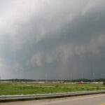
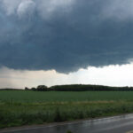
While the storm looked very crappy on radar, it did have a very well defined classic wall cloud with rotation when we got to it, so we both decided to stick to it.
The cell was moving off to the east at around 30mph, and we followed it down St Joe highway into Grand Ledge and then into Delta Township. Grand Rapids issued a Severe Thunderstorm warning on it, but the cell was exhibiting some decent rotation on radar and visually, having produced a couple rotating wall clouds that dissipated and then reformed.
I shot across Lansing on I-496, getting caught up by a lot of traffic. I did a phoner with WLNS TV 6 as I neared the east side of Lansing.
We headed down US127 where there was obviously an accident that had just happened south of the Dunckle Rd. exit, so I took that exit and headed west to Collins and down to Jolly Rd where I setup for about 10 minutes and watched as the storm continued it’s eastward movement.It was pretty obvious at this point the cell was becoming outflow dominant and wouldn’t be producing, but I still followed it east.
I did another phoner with WLNS while I headed east on Jolly Rd through Okemos. It was about that time it was producing all of the downburst damage to my north in the north sections of Meridian Township and East Lansing.
Eventually Aric and I made it east to almost Williamston and had to core because of lack of decent roads/bad choice in navigation and gave up on that cell and headed south towards the cell that was coming out of Eaton County which had shown a few good scans of rotation.
We ended up going to Leslie to intercept, but the storm had seemingly fallen apart.
A few scans later things seemed to ramp up slightly, so we headed south on US127 to Jackson and then east in hopes of getting east in case something decided to really go bonkers out east. The cell that was straddling the Ingham/Jackson line ended up ramping up a bit, and got a Severe Thunderstorm Warning reissued on it. We let the storm come to us in extreme eastern Jackson County on I-94 from an overpass, then headed east. It was about then we had a microburst or downburst of sorts, and had tree debris flying through the air onto the freeway.
We ended up in Washtenaw County just west of Ann Arbor in a Meijer parking lot where we met up with Bob Hartig and Kurt Hulst. We all decided to go have dinner at Outback in Jackson, so we headed back there to talk about the day.
Kurt and Bob had both pretty much written the next day off, but I encouraged them to look at things again and go for them as the next day looked to be BIG in Illinois and Indiana.


