Storm Chase Details
Miles Logged: 378
States Chased: MI, IN
Highest Wind Encountered: 65 MPH
Milestones: First PDS Severe Watch
Spotter Network Reports: 1
Severe Risks: SPC Outlooks
Severe Reports: Storm Reports
I knew the potential for Severe Storms was great, however, I also came to the realization that the best chance of severe weather was in the 8600 CAPE area in Central and North Central Illinois. Having worked all day Monday and having to work Tuesday, I decided that was pretty much a chase that wouldn’t happen.
After work I drove to Battle Creek and ended up sitting around for a couple hours. I filled up and washed & Rain-X’ed my windows.
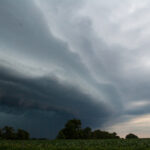
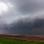
A Derecho formed in North Central IL and was heading towards the Chicago Area. I decided to start dropping southwest towards the South Bend, IN area to intercept. The SPC then issued a Particularly Dangerous Situation (PDS) Severe Thunderstorm Watch for Northwest Indiana. It was the first time I had really seen a PDS Severe watch in our area – and was the first time I had ever been IN one.
I headed down US-131 to US-20 south of Elkhart and South Bend. I took US-31 South to Lakeville, IN. I wanted to make it all the way to Plymouth, IN but knew I would never make it so I found an open spot where chances of debris hitting me would be significantly less. While I was sitting there waiting on the storm to hit me, The Weather Channel called and asked if I could do a phoner with Jim Cantore.
I ended up driving east on US-6 and not finding any damage so I drove west to where all the reports of damage was coming in from La Porte and Michigan City. I ended up finding nothing and returned home up 94 to 69 to Lansing. I pulled in around 3 am. I was at work again at 745 am the next morning. Needless to say, Tuesday I was tired.
Weather Channel Phoner
PDS Severe Thunderstorm Watch Text
PDS Severe Thunderstorm Watch 807
URGENT - IMMEDIATE BROADCAST REQUESTED
SEVERE THUNDERSTORM WATCH NUMBER 807
NWS STORM PREDICTION CENTER NORMAN OK
715 PM CDT MON AUG 4 2008

THE NWS STORM PREDICTION CENTER HAS ISSUED A
SEVERE THUNDERSTORM WATCH FOR PORTIONS OF

NORTHEAST ILLINOIS
NORTHWEST INDIANA
EXTREME SOUTHWEST LOWER MICHIGAN
LAKE MICHIGAN

EFFECTIVE THIS MONDAY NIGHT AND TUESDAY MORNING FROM 715 PM UNTIL
200 AM CDT.

…THIS IS A PARTICULARLY DANGEROUS SITUATION…

EXTREMELY DAMAGING THUNDERSTORM WIND GUSTS TO 90 MPH…LARGE HAIL
TO 2 INCHES IN DIAMETER…AND DANGEROUS LIGHTNING ARE POSSIBLE IN
THESE AREAS.

THE SEVERE THUNDERSTORM WATCH AREA IS APPROXIMATELY ALONG AND 50
STATUTE MILES NORTH AND SOUTH OF A LINE FROM 55 MILES WEST
SOUTHWEST OF MEIGS FIELD ILLINOIS TO 30 MILES SOUTHEAST OF SOUTH
BEND INDIANA. FOR A COMPLETE DEPICTION OF THE WATCH SEE THE
ASSOCIATED WATCH OUTLINE UPDATE (WOUS64 KWNS WOU7).

REMEMBER…A SEVERE THUNDERSTORM WATCH MEANS CONDITIONS ARE
FAVORABLE FOR SEVERE THUNDERSTORMS IN AND CLOSE TO THE WATCH
AREA. PERSONS IN THESE AREAS SHOULD BE ON THE LOOKOUT FOR
THREATENING WEATHER CONDITIONS AND LISTEN FOR LATER STATEMENTS
AND POSSIBLE WARNINGS. SEVERE THUNDERSTORMS CAN AND OCCASIONALLY
DO PRODUCE TORNADOES.

OTHER WATCH INFORMATION…CONTINUE…WW 806…

DISCUSSION…DEVELOPING INTENSE BOW ECHO IN NRN IL WILL LIKELY MOVE
THROUGH THE CHICAGO AREA INTO NW INDIANA DURING THE NEXT FEW HOURS.
THE MCS SHOULD MAINTAIN INTENSITY MOVING ALONG A GRADIENT OF EXTREME
INSTABILITY ACROSS NE IL INTO NW INDIANA. VERY DAMAGING WINDS WILL
BE POSSIBLE IN A NARROW SWATH INCLUDING CHICAGO…ALONG WITH AN
ISOLATED/BRIEF TORNADO AND LARGE HAIL.

AVIATION…A FEW SEVERE THUNDERSTORMS WITH HAIL SURFACE AND ALOFT
TO 2 INCHES. EXTREME TURBULENCE AND SURFACE WIND GUSTS TO 80
KNOTS. A FEW CUMULONIMBI WITH MAXIMUM TOPS TO 600. MEAN STORM
MOTION VECTOR 28050.


